The Free Geology App for Professional Fieldwork
A free geology app with strike & dip compass, barometric altimeter, real-time earthquake monitoring, 5 geological marker types, and KML/GeoJSON export — offline geological mapping made simple.
Geology Field Tools & Features
From strike & dip measurements to earthquake monitoring and GIS export — professional geological fieldwork tools in one free mobile app.
Strike & Dip Compass
Measure structural orientations in the field with a built-in digital geological compass app.
Learn more →Stereonet & Structural Analysis
Interactive equal-area stereonet, strike rose, and dip histogram built from your field measurements.
Learn more →Barometric Altimeter
Track elevation with barometric pressure trends, calibration, and vertical stats for geology fieldwork.
Learn more →5 Geological Marker Types
Drop Fault, Sample, Mineral, Outcrop, and POI markers with detailed geological data forms.
Real-time Earthquake Monitoring
Live seismic data feed with magnitudes, depths, and proximity alerts for geologists.
Learn more →Distance & Area Measurement
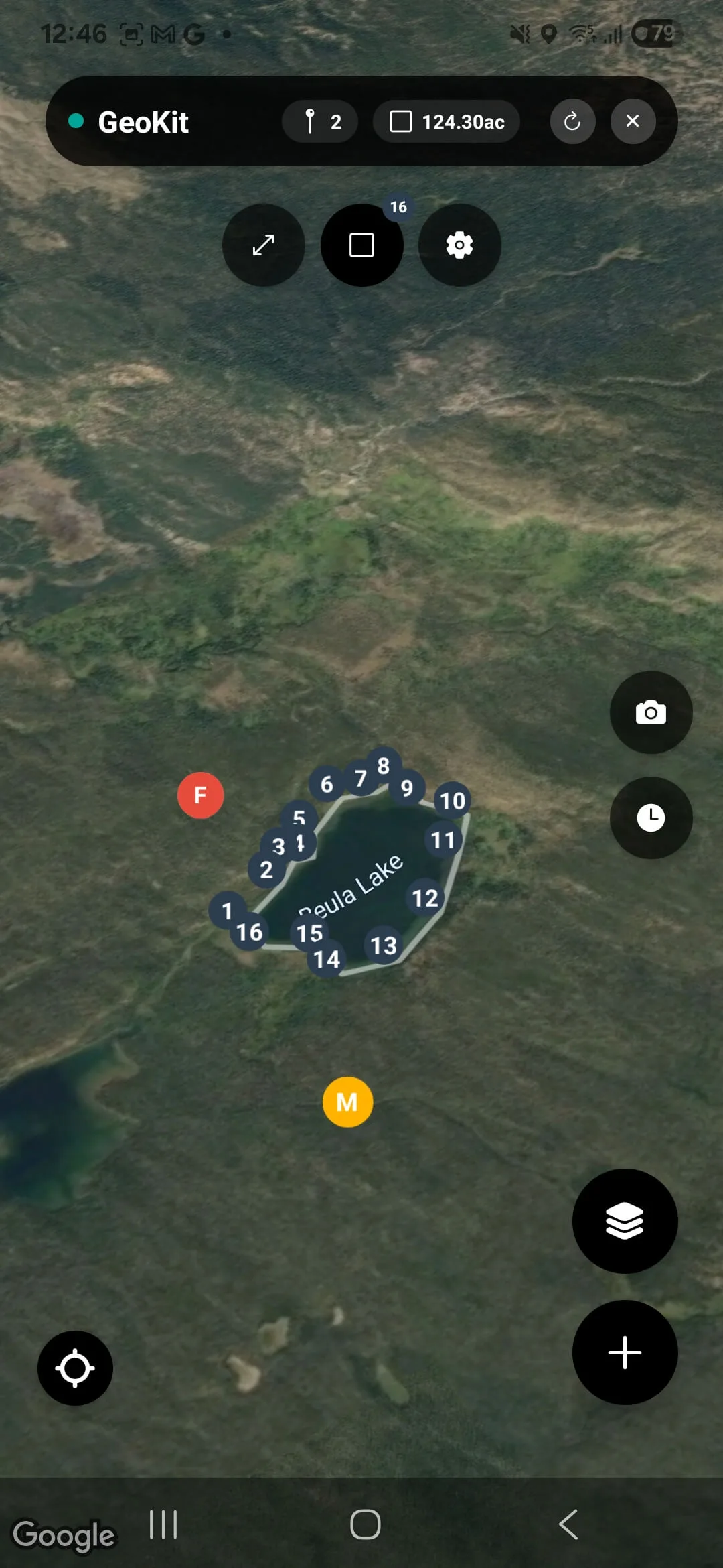
Measure distances and areas directly on geological maps with precision field tools.
Multi-layer Geological Maps
Switch between satellite, topographic, and geological base maps instantly in the field.
Offline-first & Cloud Sync
Use the full geology app offline; data syncs automatically when connectivity returns.
GIS Export (KML & GeoJSON)
Export geological field data to KML and GeoJSON for QGIS, ArcGIS, and Google Earth.
Learn more →See the Geology App in Action
Strike & Dip
Digital Compass
Altimeter
Barometric Pressure
5 Markers
Geo Data Points
Earthquakes
Live Seismic Feed
How the Geology App Works
Three simple steps to start collecting geological field data.
Download the Geology App
Get GeoKit free on iOS or Android — no subscription, no hidden fees.
Set Up
Grant location access, pick your measurement units, and you're ready to go.
Map & Measure
Drop geological markers, measure strike & dip, monitor earthquakes, and export field data.
A Geology App Built by Geologists, for Geologists
GeoKit was born from a simple frustration: existing geology tools are either too expensive, too fragmented, or too reliant on a constant internet connection. We set out to build one free, offline-first app that replaces the scattered collection of compasses, altimeters, notebooks, and GPS units that every field geologist hauls around.
Whether you're a geology student mapping your first outcrop or a seasoned researcher logging fault data across remote terrain, this free geology app gives you a geological compass, altimeter, earthquake feed, and GIS export — without the professional price tag.
Free forever
vs. expensive field software licenses
All-in-one app
vs. fragmented separate tools
Offline-first
vs. cloud-only solutions
Trusted by Field Geologists Worldwide
"So close to being the perfect all-in-one tool. It offers way more convenience than any other combination of tools I've tried for field data collection. Highly recommend!"
Syd Doman
App Store review
"If you're looking for a full-featured (and free!) field geology toolkit, this is it."
Richard Storhaug
Google Play review
"I just started testing the accuracy of this app in the field. So far, it is good."
Harold Eso
Google Play review
Frequently Asked Questions about GeoKit
Yes — 100% free with no in-app purchases, no subscriptions, and no ads. Every tool and feature is available from day one.
Yes. GeoKit's one-step digital compass measures strike, dip, and dip direction from a single placement — tilt-compensated and corrected to true north. Readings can be shown in dip-direction, right-hand-rule, or quadrant format.
Yes. GeoKit builds an interactive equal-area (Schmidt) stereonet, strike rose diagram, and dip histogram from your measurements and fault markers — free and offline. There's also a free web stereonet plotter.
Absolutely. GeoKit is offline-first. All markers, compass, altimeter, and measurements work without any internet connection. Data syncs to the cloud automatically when you reconnect.
GeoKit offers five marker types: Fault, Sample, Mineral, Outcrop, and POI (Point of Interest). Each type has its own detailed data entry form with geological fields.
Yes. GeoKit supports KML and GeoJSON export formats, making it easy to import your field data into QGIS, ArcGIS, Google Earth, and other GIS software.
GeoKit runs on both iOS and Android devices. It's built with React Native / Expo for a consistent experience across platforms.
GeoKit pulls real-time seismic data and displays earthquakes on your map with magnitude, depth, and distance information. You can filter by magnitude and set proximity alerts.
Download the Free Geology App for Your Next Field Session
Geological compass, altimeter, offline mapping, and GIS export — all free on iOS and Android. Start collecting field data today.
