Best Free Geology Apps in 2025 — Field Tools Compared
Gone are the days of carrying a separate compass, clinometer, GPS unit, and field notebook. Today's geology apps pack serious tools into your pocket. We compared the best free options available in 2025.


What We Looked For
We evaluated each app on the criteria that matter most for geological fieldwork:
1. GeoKit — Best All-in-One Geology App
GeoKit stands out as the most complete free geology app available. It combines a digital strike & dip compass, barometric altimeter, real-time earthquake monitoring, 5 geological marker types, distance/area measurement, multi-layer maps, and GIS export — all in a single app.
What sets GeoKit apart is its offline-first architecture. Every feature works without an internet connection — critical for remote fieldwork. Data syncs to the cloud automatically when you reconnect, so nothing is ever lost.


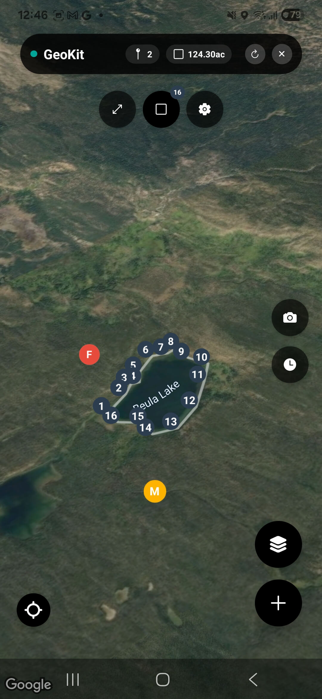
Strengths
All-in-one: compass, altimeter, earthquakes, markers, maps, export 5 specialized marker types (Fault, Sample, Mineral, Outcrop, POI) Truly free — no ads, no subscriptions, no feature locks Offline-first with automatic cloud sync KML and GeoJSON export for QGIS/ArcGIS/Google Earth
Considerations
Newer app — community is still growing No stereonet plotting (yet)
2. Fieldmove Clino
Developed by Petrolia (now part of Halliburton), Fieldmove Clino is a well-known geological compass app. It offers strike & dip measurement with a clear interface and stereonet visualization.
Strengths
Established tool, well-known in academia Built-in stereonet visualization Simple, focused compass interface
Considerations
Pro features behind paywall Limited to compass — no mapping, altimeter, or earthquake feed No KML/GeoJSON export in free version
3. RockLogger
RockLogger is a focused geological data collection app for Android. It provides compass measurements, GPS waypoints, photo logging, and basic data export.
Strengths
Free with no ads Good compass and data logging KML export support
Considerations
Android only — no iOS version No altimeter or earthquake monitoring Dated interface
4. Geologist's Tools
Geologist's Tools is a utility-focused app that provides a geological compass, unit converter, hardness scale reference, and some basic geological calculators.
Strengths
Useful reference tools (hardness scale, unit converter) Simple compass interface
Considerations
Android only Pro version required for some features No mapping, no markers, no GeoJSON export
Feature Comparison Table
| Feature | GeoKit | Fieldmove | RockLogger | Geol. Tools |
|---|---|---|---|---|
| Strike & Dip Compass | ||||
| Barometric Altimeter | ||||
| Earthquake Monitoring | ||||
| Geological Markers | ||||
| Multi-layer Maps | ||||
| KML/GeoJSON Export | ||||
| Offline Mode | ||||
| iOS + Android | ||||
| 100% Free |
Our Verdict
If you want a single free app that covers every aspect of geological fieldwork — from structural measurements to earthquake awareness to GIS export — GeoKit is the clear winner. It's the only app that combines compass, altimeter, earthquake monitoring, 5 marker types, and dual-format export in one free package on both platforms.
Fieldmove Clino remains a solid choice if you specifically need stereonet visualization and are willing to pay for pro features. RockLogger is a decent free alternative for Android users who need basic data logging.
For most geology students and field professionals, GeoKit offers the best value — professional tools at zero cost, working fully offline, with export formats that plug directly into your GIS workflow.
Try the #1 Free Geology App
GeoKit is free on iOS and Android. No subscription, no ads — just download and go.
Download GeoKit Free